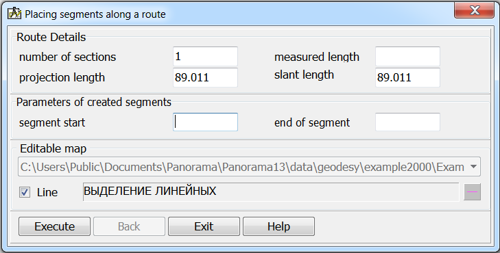
Placing segments along a route |


|
|
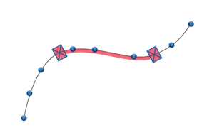
Segment - a linear object defining a fragment of the route metrics between two pickets.
The measured length of a segment by the pickets specified on a map is calculated by the formula:
SN = (MP2– MP1) MP1 – measurement up to 1 picket MP2 – measurement up to 2 picket
To perform calculations, you need to select a route on the map and then, in the dialog, enter the necessary parameters for calculating the coordinates of the segment and drawing objects onto the map.
The calculation results are presented in the form of a linear object - a segment. To draw it, the coordinates of the start and end pickets are pre-calculated. Measurements of pickets are indicated in the corresponding elements of the dialog.
|