To save the image for a graphic part of the land-plan |


|
|
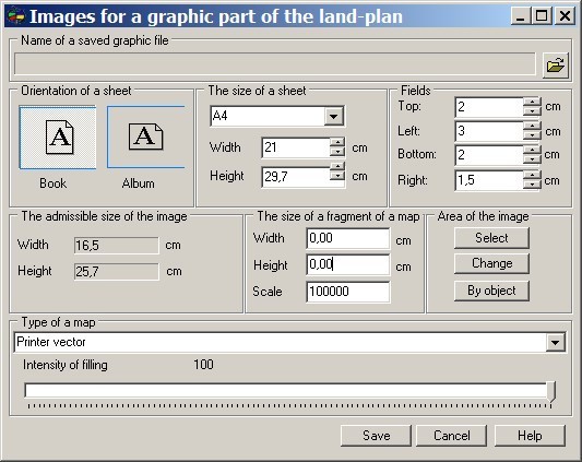
After a call of a mode the dialogue «Images for a graphic part of the land-plan» will appear. The given dialogue is intended for the visual control of the sizes of the created image. In group «The admissible size of the image» the width and height of accessible area in the document of the specified format and with the specified fields are displayed, and in «Size of a fragment of a map» group the width and height of the created image for the specified scale are displayed. By controlling by the orientation of a printed sheet, its sizes and fields you can change the admissible sizes of the image and to be convinced, that the fragment chosen by you is placed into this area. Management by these parameters should be carried out according to the sizes of templates of the form of the land-plan available for you.
For a choice of a map fragment it is necessary to press Select button, then to specify by the mouse rectangular area on a map. Dialogue «Images for a graphic part of the land-plan» will open repeatedly, and its elements will be initialized by the corresponding values. Change button is intended for moving and change of the sizes of the chosen fragment. For the termination of a mode of change of the chosen fragment's sizes, it is necessary to press Space key. The choice and change of a fragment can be made repeatedly. «Type of a map» element: - «Printer vector» - for an output of only the vector information; - «Printer raster» - for an output of the vector, raster and matrix information.
|