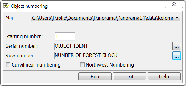
Numbering of objects, in rows |


|
|
Forest quarter, a part of the forest, delimited by cuttings or natural boundaries (for example, rivers). The division into forest quarters can be natural (borders - natural boundaries), artificial (borders - mutually perpendicular cuttings) and mixed (natural division is supplemented by cuttings). Sizes from several tens of hectares to several hundred; are established depending on the category of taxation works, and the category - on the degree of using the timber. Each quarter has a permanent number.
According to current standards, the numbering of quarters in the forestland goes from west to east, in rows, from north to south. For the convenience of using the mode when numbering other types of accounting objects, the «Curvilinear numbering» element provides counter-numbering of even and odd rows. The odd row is from west to east, the even row is from east to west. When the option «Numbering from the northwest point» is enabled, the numbering of objects is performed in accordance with the distance of the object from the northwest corner of the total dimensions of the objects being processed.
|