Creating sheets of map by coordinates |


|
|
The task is intended for forming topographic works region by preset sizes or by the nomenclature of a sheet. The task can be called from the main menu by two ways: - File/Create/Region by coordinates - Tools/Run Applications
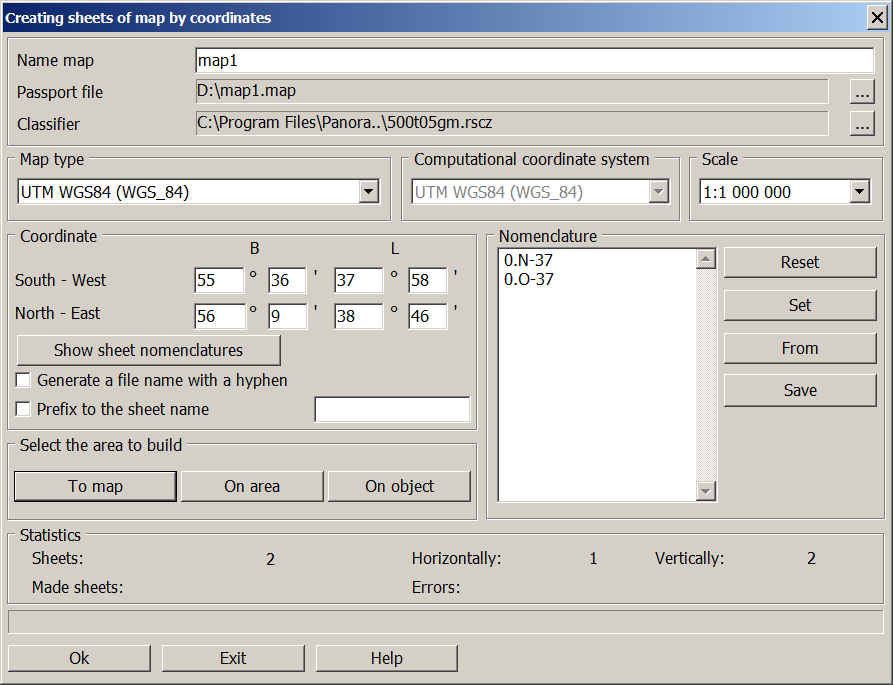
Necessary and sufficient conditions for creation of region are the following: 1. Input into corresponding fields of Creating sheets of map by coordinates dialog window: - name of a created map; - name of a passport file of a new map; - name of the classifier; - map scale.
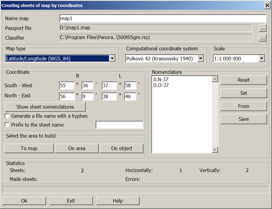
2. Assignment of geodetic sizes or the list of nomenclatures by which the works region is created. 3. For creating sheets of a topographic map it is necessary to choose one of listed in the drop-down list the map type: - Pulkovo 42 (Krassowsky 1940); - Pulkovo 95 (Krassowsky 1940); - UTM WGS84 (WGS_84); - Latitude/Longitude (WGS_84); - Latitude/Longitude (Krassowsky 1940); - World Map (Miller Cilindrica); - VN-2000 Vietnam; - Large scale plan.
At creating sheets for the region which covers more than three six-degree zones, it is expedient to use type of a map the Latitude/longitude. For input of geodetic sizes B (latitude) and L (longitude) in degrees and minutes of the bottom left corner and the top right corner of created region it is necessary to place the mouse cursor in corresponding window B or L and to press the left mouse button. Transition into the following edited window is possible by Tab key. Sizes of works region can be established by means of a choice by the mouse of object or a fragment on a map. These modes are available only when calling the dialog via the main menu item Tools/Run Applications. If the region dimensions are used to form sheets, viewing the created nomenclatures is carried out by clicking the Show sheet nomenclatures button. Nomenclature of created sheet should be formed according to the standard rules of a designation of map sheet. Nomenclature marked by "*" is erroneous. To create a sheet by the preset nomenclature it is necessary to press Set button. List of nomenclatures which are displayed in a dialog window in the Nomenclature bookmark may be saved into a text file and in the subsequent be used for drawing the frameworks of sheets onto a map in the mode Load from file. For output maps of WORLDMAP and MAPSPHERE types the type of the topographic computational coordinate system is set, according to which the sheet frames are formed.
At creation of the plan, except of execution of item 1 of the given document, it is necessary to enter coordinates of corners of the rectangular frame limiting region, and the sizes of one sheet. The mode of borders alignment of region provides change both the bottom border, and the top border, establishing these values multiple to the size of a sheet. For plans of scales 1:2000, 1:1000, 1:500 the nomenclature is formed in view of coordinates of southwest corner XY. For example, if X = 6172000, Y = 3234000 the nomenclature of a sheet of scale 1:2000 looks like: 72-34. For scale 1:1000 the nomenclature is supplemented by a serial number from 1 up to 4: 72-34-2. For scale 1:500 numbering changes from 1 up to 16: 72-34-02. Press Ok button to start process of working.
|