Loading coordinates from a text file |


|
|
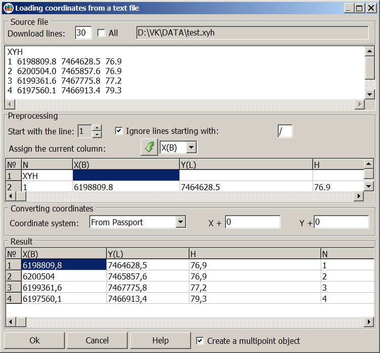
The process of loading the coordinates of created object from a text file can be divided into the following stages: - choose the type of created object and the mode of mapping object(s); - choice of loaded file; - setting up scenario of load (format of source file); - immediate processing of loaded file, the formation and recording object (s) onto the map.
Dialog of loading coordinates from a text file is used to set up scenario of load, ie clarify the format of the source file being downloaded. Opening a file and automatically recognizing its format will be done at the start of the dialog. Herewith: - the information contained in the downloadable file is automatically divided into columns (a space or a tab is recognized as the delimiter); - the second line of the file is set as the first processed row; - symbol "/" is set as a character that starts a comment line. If the automatic recognition of file successfully, to columns is assigned a data type. If not, the data type to columns must be set manually. To do this, "click" the appropriate column of the table pre-treatment to choose for her the appropriate type and click the arrow button.
The result table is filled only if the column X and Y are assigned. Button "Execute" is active only if X and Y columns are filled. If the columns X and Y are not assigned or appointed is not unique (assigned multiple columns of X or Y) under the table of the result a message is compiled. If necessary, during the loading process you can perform the coordinate transformation (to add the offset coordinates for the X and Y). In addition, if the loaded coordinates are in the local coordinate system and in the GIS the parameters of this system are set, you can download the coordinates with transforming them to a map coordinate system.
When the Create a multipoint object option is enabled, an object of the Point type is created, the metric of which contains a sequence of points with one set of attributes.
|