Parameters for displaying nautical maps of the S52 standard |


|
|
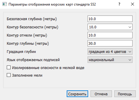
The task is designed to customize the display of sea maps according to the user's needs. The task is launched using the menu item «View» → «View of the sea chart». This will open the dialog shown in the figure.
Dialog box «Parameters for displaying nautical maps of the S52 standard»
Задача позволяет изменять следующие параметры отображения:
The task updates the described display parameters in the main application INI file (section [S57NAVY]).
|