Drawing of points of engineering-geological researches (boreholes) |


|
|
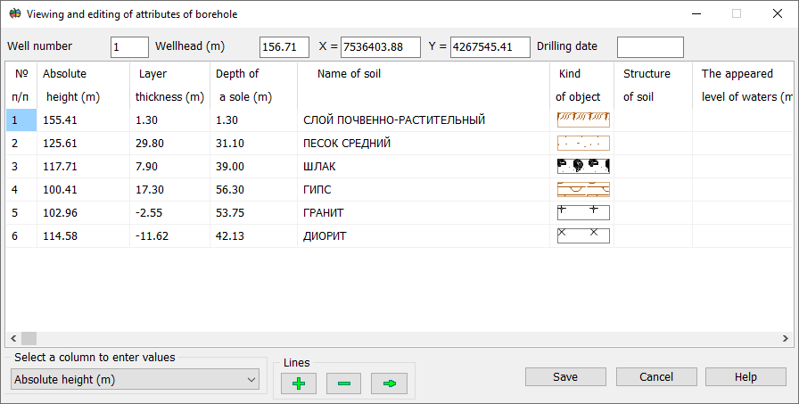
RECOMMENDATIONS. Borehole attribute data should be entered using the «Viewing and editing of attributes of borehole» mode.
|
Drawing of points of engineering-geological researches (boreholes) |
|
|
RECOMMENDATIONS. Borehole attribute data should be entered using the «Viewing and editing of attributes of borehole» mode.
|