Construction of a drainage area |


|
|
Dialog view
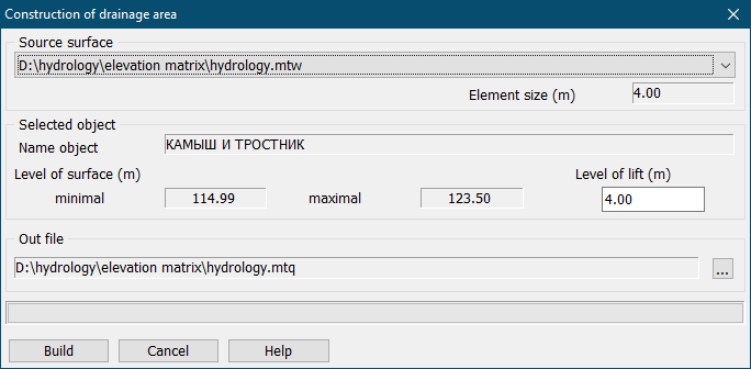
This mode allows to define drainage zones on a map, using the information from elevation matrix. Construction of a drainage zone of area of the specified basin can be performed in the presence of matrix of a relief of a basin bottom. The construction is performed within the user-selected areal hydrography object (lake, reservoir and so forth). The file of elevation matrix for construction of a drainage area is selected from the list «Source surface». Result of construction is the matrix of qualities in which "depths" of the drained area are entered. To construct a drainage area, it is necessary to select an areal object on the map, within which a matrix of qualities will be built. The elevations values of the minimum and maximum surface levels are determined using queries from the elevation matrix in points of the metrics of the selected object. To build a zone, in the «Level of lift» field, the user sets the amount of water level decrease relative to the level of surface of the selected areal hydrography object. The level of lift value is set as a positive number, by default it is equal to half the difference between the maximum and minimum levels. In the process of construction there are used: - the upper level of the water surface; - the lower level of the water surface (the difference between the upper level and the value of the decrease). As a result of construction the matrix of the qualities is created, the element size of which is equal to the size of an element of a matrix of a bottom's relief.
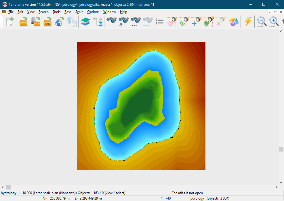
Matrix the top view
In the area of the matrix of qualities, where the bottom relief is located below the lower level of the water surface, the quality values are not entered.
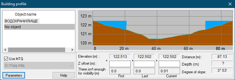
Matrix the profile
Into the area of the matrix of qualities, where the bottom relief is located above the lower level of the water surface, the differences between the upper level of the water surface and the height of the bottom relief are entered. Thus, the «depths» of the drained area are entered into the matrix.
|