Correction and input of new layers |


|
|
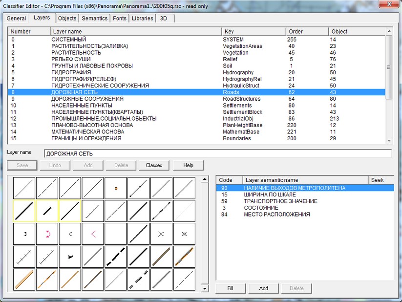
In Layers editing dialog the list of classifier layers is represented as a table with 5 pillars: number of layer, layer name, key, displaying order, number of objects. For addition of a new layer it is necessary to click Add button. At the end of the layers list the highlighted string with a new number will appear. After left mouse button click a layer name will be written into Layer name field, number of layer output - into Order field, short name of a layer - into Key field. Into Number of objects field the input is prohibited. The input of the information in each pillar happens at pressing of Enter button. The editing of a layer guesses change of layer name or displaying order. Changed layer is selected by mouse, and the new values are entered into the necessary pillar. Input is ended by pressing Enter button. The key will be used for link with databases (for fields names) and this name should be formed with allowance for requirements of base. You can sort out layers by number, by name or by displaying order at pressing of appropriate buttons in Sort by group. Objects, which belong to layer, are displayed at the bottom of the dialog, at the left. By double click on the object's image a transition into the table of objects happens.
Operations with semantics of layer;
Display order The general order of displaying map objects: 1) polygon (below all); 2) line; 3) point; 4) vector; 5) titles and mixed (above all).
This order of display is valid for all map objects, regardless of the order of displaying layers and an order of objects in a layer.
Classifier objects are divided into layers. Each layer has its own position. The layer "Vegetation" is usually displayed below the others. Further there are layers: «Hydrography», «Hydroengineering constructions», «Road network», «Settlements». Above there are located: «Boundaries and enclosures», «Plan-hight base», «Mathematical base». The value of the order «0» corresponds to the lowermost objects, «255» - to the upper one. The order of displaying layers is customized in the classifier editor («Layers» bookmark). Objects in the layer can also have their own order of display - in accordance with the priority of significance. For example, objects with simple contours («Earthen country roads», «Field, forest roads») are displayed below two-contour objects («Improved earthen roads») which are displayed below two-contour orange objects («Road with cover», «Road with advanced cover») and three-contour objects («Main roads»). The value of the order «0» corresponds to the lowermost objects, «255» - to the upper one. The order of displaying objects in a layer is customized in the classifier editor («Layers» bookmark, the button «Objects order»).
|