Working with service |


|
|
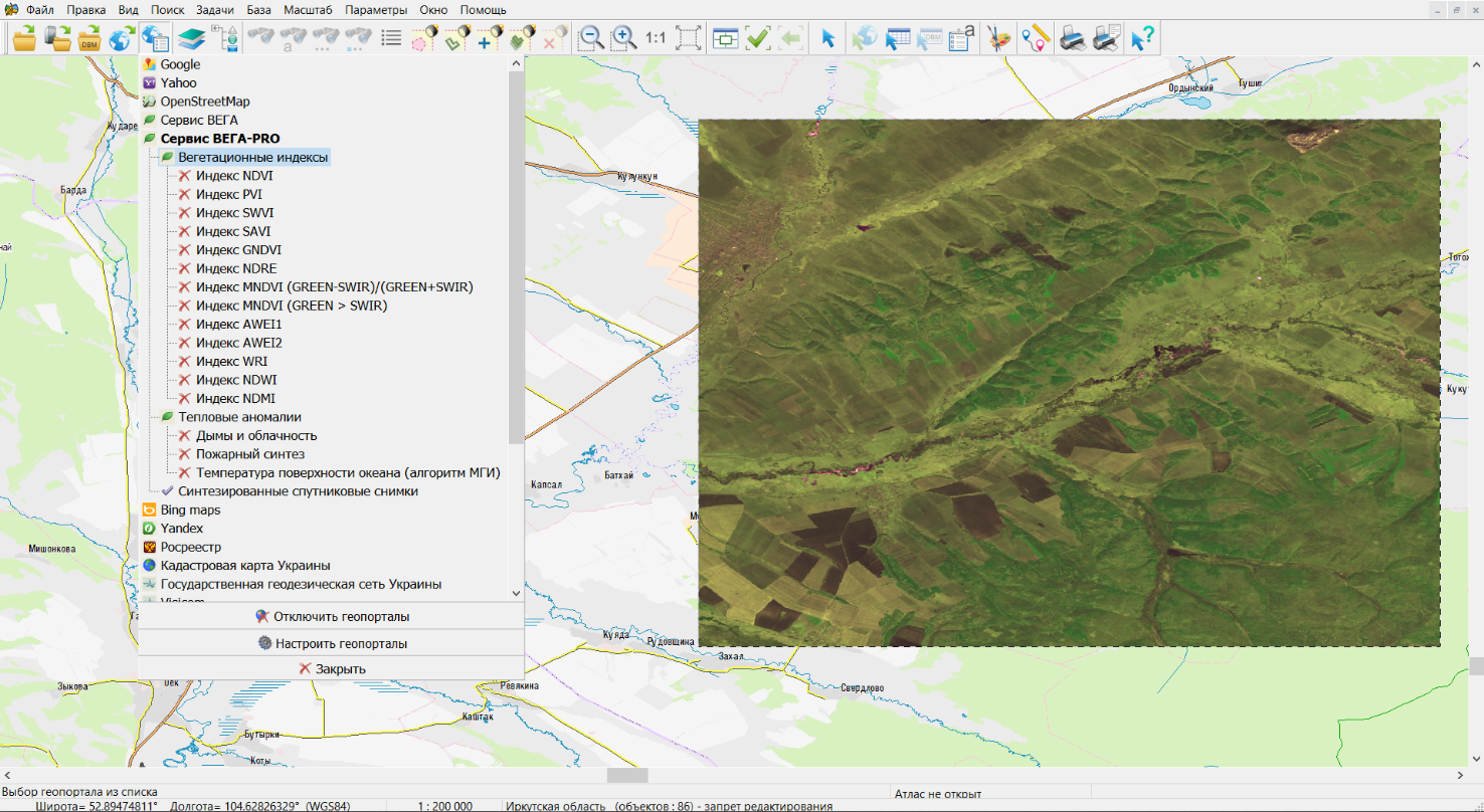
Service data is available in the form of separate geoportals depending on the purpose of use and the type of data. To connect the service, it is necessary to connect the required geoportal from the «VEGA-PRO» section in the geoportals menu, which is available by clicking the «Show geoportal list» button on the main panel. If there is a username with a password or an access key, they should be entered in the dialog «Geoportal settings» - «Authorization parameters». After selecting a geoportal with the required data type, the search and display of the layer of images for the current date that fall into the area of the map visible on the screen will be performed. To receive and view data onto another area, you should reopen the service geoportal, having previously moved the screen to a new area.
Connection to VEGA-PRO service:
When requesting available images, the filtration by date and percentage of cloudiness, with limitation of the maximum number of displayed images is carried out. The maximum allowable cloudiness percentage of images can be customized in the xml file with the list of geoportals by editing the value in the <MaxCloudCover> tag. The limit of the number of found images is customized in the <Limit> tag. Large values increase the amount of data displayed at a time, but slow down the speed of the service work. Satellite imagery data can be filtered by shooting date using the «Date/time of geoportal» dialog. The dialog is called from the «Select request time" item of the context menu by right-clicking on the geoportal in the list. The date of the imagery can be selected in the calendar in the «Date« item, entered in text form, or customized by using the keyboard up and down keys. After each date change, a new request and display of images from the service is performed, which allows you to quickly browse the dates in search of suitable images and can be used to monitor a specific area.
|