Editing of general data of the classifier |


|
|
The classifier is edited if the classifier is open for recording. Otherwise, you can edit most of the fields, but they will not be saved and a warning will be displayed in the status bar at the bottom of the Classifier Editor dialog. If the classifier is open only for reading, there is a corresponding entry about it in the upper right corner of the dialog.
Editing the general data of the classifier allows: - select a classifier for correction; - set the basic boundaries for displaying objects; - edit properties, code, map type; - create a symbol map; - create XSD schema; - translate the classifier into another language; - import data from another classifier; - print classifier to text file.
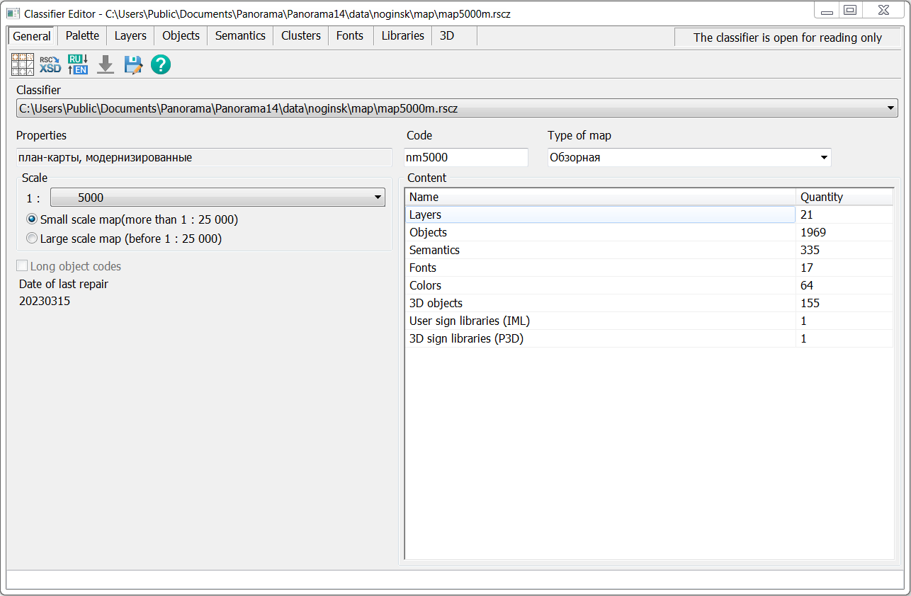
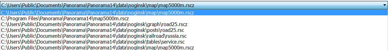
You can edit the open map classifier or one of the user map classifiers. The name of the editing classifier file is selected from the drop-down list of classifiers by clicking on the Classifier field.
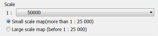
The custom (conditional) name of the classifier is edited by clicking on the Properties field. The length of the classifier name is up to 255 characters. This field is for reference only. The map type is selected from the drop-down list of map types or entered by the user arbitrarily (up to 255 characters) by clicking on the Map type field. This field is for reference only. The Scale field is intended for entering a reference value of the base scale of the map, on which the classifier is compiled. The value of the Scale field does not impose restrictions on the use with maps of a different base scale. The scale is selected from the list of scales. The boundaries of visibility of objects on the map are set by two lists of scales - for small-scale maps and for large-scale ones. For maps with scales from 1:1 to 1:10000, it is advisable to select the Large-scale value, for other maps - Small-scale. For small-scale maps, the visibility boundaries of objects can take on the following values: 1:1000, 1:2000, 1:5000, 1:10000, 1:25000, 1:50000, 1:100000, 1:200000, 1:500000, 1:1000000, 1:2500000, 1:5000000, 1:10000000, 1:20000000, 1:40000000. For large-scale maps, the visibility boundaries of objects can take on the following values: 1:1, 1:10, 1:25, 1:50, 1:100, 1:200, 1:500, 1:1000, 1:2000, 1:5000, 1:10000, 1:25000, 1:50000, 1:100000, 1:200000, 1:500000.
The classifier code (7 characters) is edited by clicking on the Code field. This field is for reference only. The right part of the tab contains information about the composition of the classifier: the total number of layers, objects, semantics, fonts, colors, 3D views of objects, user libraries iml and 3D symbols. The bottom left part of the dialog displays information about the date the classifier was last modified and the name of the computer on which editing was performed. The upper part of the dialog contains an additional panel with tasks that include the following modes: - - - - -
Saving changes is done automatically in the working copy of the classifier, if the classifier is open for writing. But when exiting the dialog of the Classifier Editor, a question is asked about the final saving of all the changes made. If the user decides not to save the changes, then the classifier is restored from the saved copy.
|