Creation of protocol of GPS-measurements |


|
|
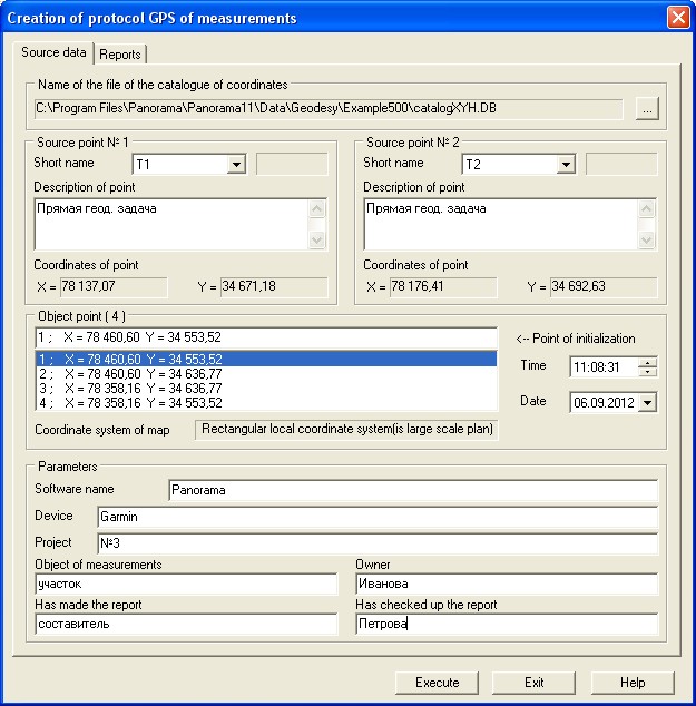
Source data bookmark:
Source point №1 and Source point №2 groups are intended for displaying the list of points of a global geodetic satellite network and a choice of those points concerning which a measurement of the GPS-receiver is made. Current points (№1 and №2 ) are selected from the list by a short name. The description of the chosen point and its coordinates are displayed in elements: Description of point and Coordinates of point accordingly. For filling lists of points of a global geodetic satellite network it is necessary to open "Catalogue of coordinates" base. In group "Name of the file of the catalogue of coordinates" click by the button <…> . Selected points objects group is intended for display of the list of the selected points measured on object (point objects), or the list of points of the chosen object (polygon or line), and also for a choice of a point of "initialization" from the specified list. Parameters group is intended for input of the information on object. Following fields are filled: address of a plot, owner of a plot, a surname and the initials of the drawer, etc. Values of parameters are remembered in an INI-file of the document for use in the subsequent sessions.
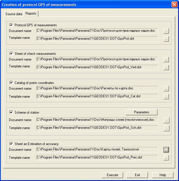
Reports bookmark:
Protocol of GPS-measurements group is intended for a choice of a file name of the formed document: Summary protocol of GPS-measurements on object .Template: ... \Panorama11 \Geodesy.dot \GpsProt.dot corresponds to the document. The document is formed, if in Protocol of GPS-measurements field the tick is set. Sheet of check measurements group is intended for a choice of a file name of the formed document: Sheet of check measurements of the sides of polygon on object . Template: ... \Panorama11 \Geodesy.dot \GpsProt_Ved.dot corresponds to the document. The document is formed, if in Sheet of check measurements field the tick is set. Catalog of points coordinates group is intended for a choice of a file name of the formed document: Catalogue of coordinates of surveying signs installed by border of object .Template: ... \Panorama11 \Geodesy.dot \GpsProt_Cat.dot corresponds to the document. The document is formed, if in Catalog of points coordinates field the tick is set. Scheme of station group is intended for a choice of a file name of the formed document: Scheme of location of base and defined stations and set-up of parameters of formation and print of the scheme (Parameters button). Template: ... \Panorama11 \Geodesy.dot \GpsProt_Sch.dot corresponds to the document. The document is formed, if in Scheme of stations field the tick is set. Sheet an Estimation of accuracy group is intended for a choice of a file name of the formed document: Sheet of an estimation of accuracy of coordinates definition of land-marks . Template: ... \Panorama11 \Geodesy.dot \GpsProt_Prec.dot corresponds to the document. The document is formed, if in Sheet an Estimation of accuracy field the tick is set. |