The description work of dialogue XML |


|
|
Dialogue is intended for loading data from a cadastre of realty. During an execution of a mode on a map the objects can be created: - cadastral quarter (polygon object), a contour of cadastral quarter from edgess (linear objects); - a plot (polygon object), a contour of a plot from edges (linear objects); - parts of a plot (polygon objects), a contour of a plot's parts from edges (linear objects); - rotary points (point objects).
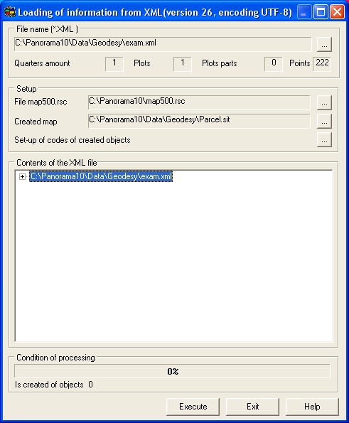
File name (*.XML) group is intended for a choice and display of a loaded file of a realty cadastre XML. After a choice of a name the reading a file and the analysis of its structure is carried out, fields of statistics are filled. The program processes files of a realty cadastre XML with the version of structure 1.0, with coding UTF-8, with version of the scheme 26.
Setup group is intended for: - Choice of a filename of the classifier with which the map will be created. To functionings of the given mode the classifier map500.rsc is set up. At use of other classifier preliminarily it is necessary to set up it - for objects: Cadastral quarter , Plot , Plots parts , Border (edge) , Point to install the corresponding semantics. - Indications of a filename of a created map. - Managements of objects structure of a created map is carried out by means of dialogue: Set-up of codes of created objects . Creation of objects of a realty cadastre on a map begins after pressing the Execute button. In a field "Is created of objects" the total of the objects created on a map is displayed.
|