Export of vector data into GML format |


|
|
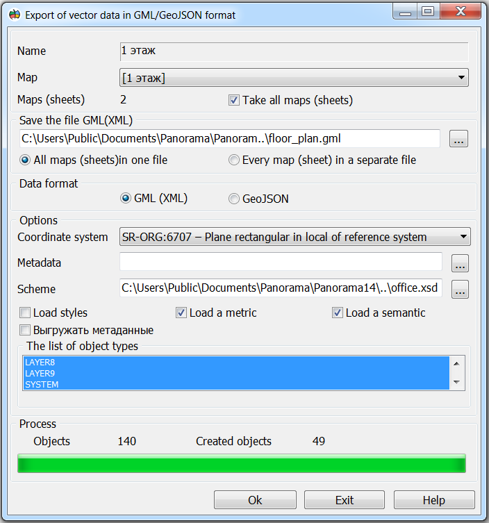
The task is intended for export of data from the GIS Map 2011 into files of GML format (Geography Markup Language) in accordance with the «Specification of data for exchange of digital topographical maps in GML format». The specification is developed on the basis of using a subset of the schemes components specified in the standard OpenGIS Geography Markup Language (GML) Encoding Standard Version: 3.2.1 and requirements of standards ISO of a series 19100. The program also supports the export of data into text format of data exchange JSON (JavaScript Object Notation). The data set includes metadata of a data set, dimensions of the spatial description of all objects and the description of one or several objects. Data about any object include the unique identifier of object in a data set, the name of object, the properties of object specified in the applied scheme, and the description of spatial position of object.
Description of separate object is contained within an element gml: featureMember, which has the attribute gml: id. This attribute should contain the identifier of an object instance whose value must be unique within the data set. The spatial position of the object should contain the coordinates of the object in the global geodetic coordinate system in degrees or position in the local coordinate system in meters. Coordinates can be set in two-dimensional (2D) or three-dimensional (3D) system. Coordinates of all points of one object should be in one coordinate system and have uniform dimension. Coordinates of different objects can have different dimension. To specify in the description of object its some properties it is preliminary necessary to describe them in the applied scheme. The applied scheme allows to declare new types of objects and a set of their properties. Types of objects and their properties are described according to the classifier of a subject domain (the catalog of objects). Applied XML scheme defines the structure of the created document, the names of elements and attributes, data type of these elements, default values. The file containing the XML schema usually has the extension «.xsd» and can be created by the map classifier. Types of objects («layers») which are contained in XML scheme, are listed in the field List of objects types and can be stored into GML file selectively at will of the user. For viewing the scheme it is necessary to do double click in the field Scheme of data at presence of the http-address in line. The file with extension «.xml» which name is set by a string in the field Metadata - should contain metadata of a created data set. To install the a projection of the created document the code of geodetic system of coordinates in database EPSG is set, by default the Geodetic on spheroid WGS-84. If in the map passport the Map type - Large scale plan is set, then the coordinates are written into the GML format with the indicating the conditional coordinate system SR-ORG:67-07 - with the values that are on the map. The name of formed GML file automatically is set by name of the initial map and can be changed. If the multisheet map is opened or in the list of maps there are several maps it is possible to choose a mode Process all maps or a mode of processing of one map chosen from the list. Accordingly, the results of processing can be placed into one GML file or you can create for each sheet a separate file at activation of a mode Each map in a separate file. The error log is formed according to the selected XSD scheme for FSIS TP.
|