Editing passport |


|
|
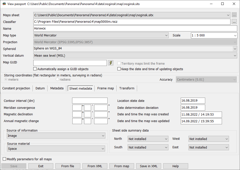
Passport data include: - name of region; - map type; - projection of source material; - kind of spheroid; - vertical datum; - scale for multisheet maps; - way of storing coordinates; - constant projections; - metadata; - coordinates of a map.
Vector map is a multiscale map. The scale indicated in the map passport is used as the base scale when publishing the map. In a base scale the sizes of all conventional symbols, thicknesses of lines and height of titles (in millimeters) correspond to those indicated in symbol parameters. For maps, the territory of which is not limited by the frame, scale change is permissible. If the map contains too dense clusters of large conventional symbols, it is recommended to reduce the scale denominator in the passport. If the denominator is reduced from 100 000 to 10 000, the relative sizes of all symbols will decrease by 10 times.
The nomenclature of a sheet can not be edited for topographical maps of a standard division, because by its value the calculation of sheet coordinates is made. Coordinates of a sheet for this type of maps also are not a subject to editing.
Dialog view:
When you click on the button From file the data are read from the main document and automatically placed into fields of dialog.
By means of the button By Map the dialog «Import of projection parameters» is called. Data about a projection of selected map will be written down into dialog of the passport, further it is possible to make necessary changes.
By the button From XML you call task Parameters of reference systems from XML file which reads values of constant projections and Datum from the file .xml. By clicking the button Write in XML the task «Parameters of reference systems from XML file» is called which allows to edit file .xml.
|