Import of territorial planned data from GML |


|
|
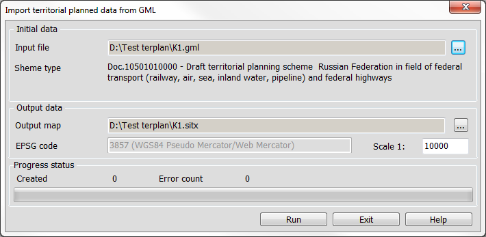
The converter is used to import documents of territorial planning in GML format onto a map.
In the field «Initial data» by pressing the button «…» the input file of the territorial planning document in XML format is selected. After the file is selected, its composition is roughly scanned and the «Scheme type» and «EPSG code» fields are filled. The bookmark «Output data» contains: The «Output map» field is used to display the full path to the resulting map. The path to the map is selected by the «…» button. The «EPSG Code» field is inactive and is used to display the coordinate system in the open GML file. The «Scale» field is used to select the scale of the created map. When you open the gml file, the document of territorial planning according to which the file was created is displayed in the top part of the form. When opening the converter or loading a GML file, the program detects the type of document and looks for schemes in the folder with GIS Panorama in the “\Terrplan.XSD” directory. The «Process status» field in the top bar shows the general import process. The number of processed objects and errors are displayed in the corresponding fields. The list of errors is saved in a log, which is a text file. The log is located in the log folder with the map and has the «.gml.log» extension.
|