Cutting map by borders of regions |


|
|
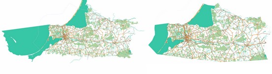
Despite the conditional layout of the source data by countries and regions, they may contain objects that go beyond the actual boundaries of the territory. In order to remove or cut off such objects, as well as to cut the region into smaller areas (or select a separate area from the general region), you can perform the «Cutting» procedure. Map of the Kaliningrad region before and after cutting
The contour of the object, along which the area is cut, can contain tens and even hundreds of thousands of points. As a result, the process of directly cutting large regions without the use of special methods can take a very long time (several weeks). Therefore, the cutting of the map is performed according to a pre-prepared cutting map. To prepare a cutting map, the following steps are performed: 1. Onto a map (new or already having other templates of cutting) the object is transferred by which a cutting will be carried out. Previously, before transferring an object onto the cutting map, additional contours - subobjects - must be removed from it. The contour must be one. Enclaves are cut into separate regions. In addition, the absence of self-crossing must be checked. The object must be a closed linear one and in the «Name» semantics (characteristic code 9) contain a unique name for the generated map of cutting. 2. Based on the contour of cutting, a template of cutting is formed. To object-contour of cutting by means of the Map Editor and construction of buffer zones there are added two subobjects (internal and external), roughly repeating outlines of the main contour. It is recommended to add the external subobject first, and after that - the internal one. The fewer points the additional sub-objects have and the closer they are to the main one, the faster the process of cutting will be. The main requirement: the contours must not cross with each other and must not have self-crossing!
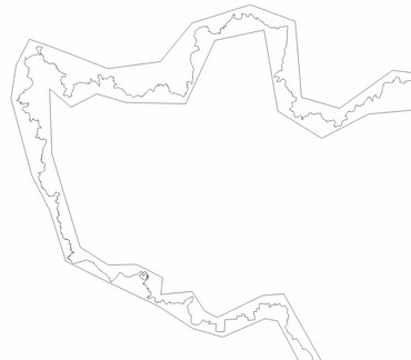
Template of cutting
Map of cutting of the Central Federal District of the Russian Federation
When a map of cutting is selected in the dialog for importing data from the OSM format, an analysis is made of the overlap between the templates of cutting existing on it and the map specified as the source data. In this case, only templates that have a real overlap with the processed map remain in the «Cut by:» list. Therefore, you can store all used templates on one map. However, it is recommended to create a separate map for each data file downloaded from the Internet in OSM format. |