Import from OSM format |


|
|
Procedure is intended for loading the vector data from exchange OSM format.
When choosing a source map, a selection of OSM, MAP, SIT, SITX files is available. A complete technological scheme for importing data from the OSM format includes the following steps:
However, all modes of the technological scheme are independent. It is possible to choose for processing all, one or several modes. The only strict restriction is the obligatory execution of Import when choosing an OSM file as a source map. In other cases it is possible to execute any set of processes (except Import). For example, decoding and correction or Formation of signatures and their generalization. Some mode sequences may be executable but nonsensical. For example, it makes no sense to sort an undecoded map, because on it, all objects belong to one System layer. The total progress status of the processing and the progress status of the current process are displayed on the information bars. In addition, the dialog box displays information about the time elapsed since the general start of the procedure and the start of the current process. And also approximately the remaining time is calculated. The total status of the processing process is duplicated on the GIS icon in the Windows taskbar The completion of all processes is signaled by the yellow color of the icon
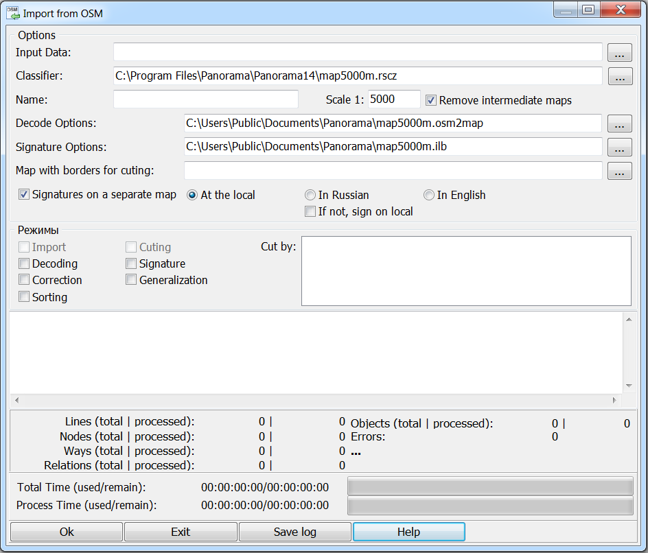
To perform the procedure, select the input data file, a digital classifier (RSC file), which will be used to generate the output map, a dictionary ( file of decoding parameters) that corresponds to the selected classifier, select a file of parametres of signatures formation, and also specify the denominator of the scale of the created map. At the start of the program «by default» it is proposed to import according to the map5000m.rscz classifier included in the installation kit and the corresponding files of recoding parameters map5000m.osm2map and map5000m.rsc.ilb.
|