Saving vector map into file of BMP, TIFF, RSW, PNG, KMZ formats |


|
|
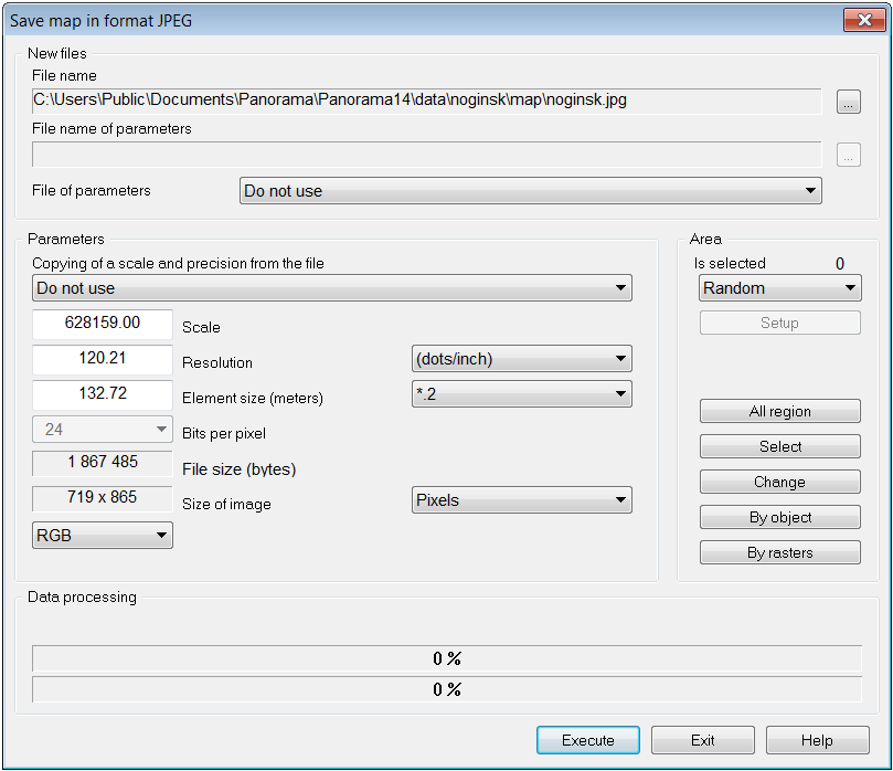
The mode is intended for saving the chosen map fragment into file of BMP, TIFF, RSW, PNG, KMZ formats. Any digital vector map fragment of any contents, any kind etc. may be saved. In the future, the generated graphic files can be used in third-party applications. The opportunity of the stream saving of map image into graphic files by dimensions of the selected objects (by sheets frame) is realized. The saved KMZ file is an archive of the KML file and a set of raster tiles. The KML file contains a description of the raster's data parameters - the files names and the coordinates of binding the raster tiles, and also the priority of their drawing.
Choice and change the saved map fragment
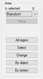
All region button installs all region as saved area. The Select button is used to select a fragment of the saved map image. When you press the Select button, the dialog closes to allow you to specify on the map a fragment of the saved image by selecting two points. After selecting a fragment, the dialog Save map into file of BMP, TIFF, RSW format will open again. Change button is intended for change of the selected fragment. Set a check mark in the No border element if the selected object should not be included into the formed image. The No border element is available after selecting the region to be saved by the object. Enable the Clean outside element to hide the image outside the object's borders. By rasters button sets the size of the saved area according to the dimensions of all displayed rasters. This takes into account the use of the raster frame (Display frame raster). The selection and change of a fragment can be performed many times.
Parameters of the saved image
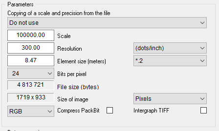
When copying a fragment of a document into a file in BMP, TIFF, RSW formats, you must specify the following characteristics of the saved image: - scale (Scale field); - resolution capability (Resolution field); - the element size in meters ( Element size (meters) field); - bit amount on an element (Bits per pixel field); - type of color model (RGB, CMYK) - for TIFF and BMP.
The choice of type of color model for TIFF and BMP is possible in a mode of 32 bits per pixel. At forming a TIFF-file the file with CMYK color model is created. If extension of created file BMP then four BMP-file with a gray-scale palette (256 gradation of grey color) are formed. Formed files have the prefixes corresponding to channels of color separation of CMYK model. For example at a choice of a filename Map.bmp, files: Map-C.bmp, Map-M.bmp, Map-Y.bmp, Map-K.bmp will be created. The size of the fragment and the specified parameters are used to estimate the size of the saved file, which is displayed in the File size field.
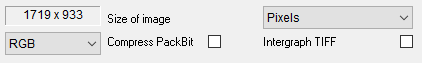
When copying a fragment of a document into a TIFF file, additional options can be used: - To write down a matrix of transformation into TIFF header. It allows to Intergraph system to distinguish a binding of the raster image automatically. For writing down a matrix of transformation into TIFF put a tick in a dialog element: Intergraph TIFF. - To apply a method of image compression PackBit. For receiving the compressed TIFF-file put a tick in a dialog element: Compress PackBit.
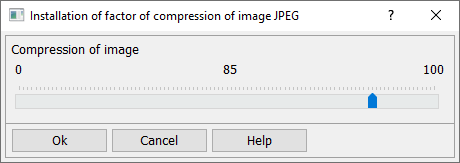
When copying a fragment of a document into a JPEG file, you can set the JPEG compression ratio of the image:
Use of parameters file
A parameters file is provided to save the parameters of image binding. When loading a graphic file into a raster map, you can use the created here parameters file for automatic binding the loaded image. To use a raster's parameters file, select a parameters file type from the File of parametres drop-down list and specify its name in the File name of parameters field. In the current version, the following parameter files are processed: world file, .TAB binding file (MapInfo)
Setting the parameters of the output raster
Recommendations for saving mosaics of space and aerial photographs
Mode of stream saving map images into graphic files
Recommendations for saving an image of right of way
Mode of saving the map image into graphic files by page format
|