Object intersection control |


|
|
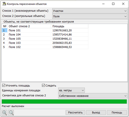
The result of the mode operation is the list of objects in list 2 that do not meet the control requirement. To start calculations, you must select the lists of objects in the drop-down menus and click the «Calculate» button. Different lists should be selected. The results of the calculation of multiple overlays will be shown in the table. As the identification information, displayed in the field of the table «Object from the List 2», there is used the semantics selected in the drop-down list «Semantics for the list of objects 2». This list is formed from the list of semantics of the first object of list 2 (the first object of the map having the minimum number in the list of maps). If the semantics «Name» (code 9) is not found in the list of semantics, it is forcibly written into the end of the list. Into the field of the table with the name «Square», the area of objects from the list 2 is entered. Tag «Clarify area» carries out information function and is not available for change, it duplicates the value of the tag «Precise square and length» from the «Options» section of the main menu of the program. If the «Trace» check-box is used, while moving through the table, the map will be positioned on the object selected in the table, and this object will be highlighted on the map.
|