The procedure for connecting an arbitrary geoportal according to the TMS standard |


|
|
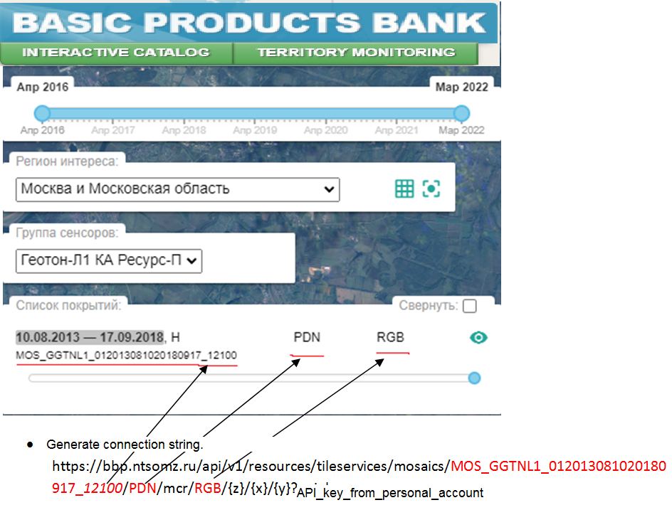
The procedure for connecting an arbitrary geoportal according to the TMS standard on the example of the Basic Products Bank of Russian Space Systems (RSS). • Get an API key in your personal account. • Go to the website of the Basic Products Bank of RSS https://bbp.ntsomz.ru/bsp/ • Pass the authentication procedure. • Select region of interest, select sensor group, select coverage of interest.
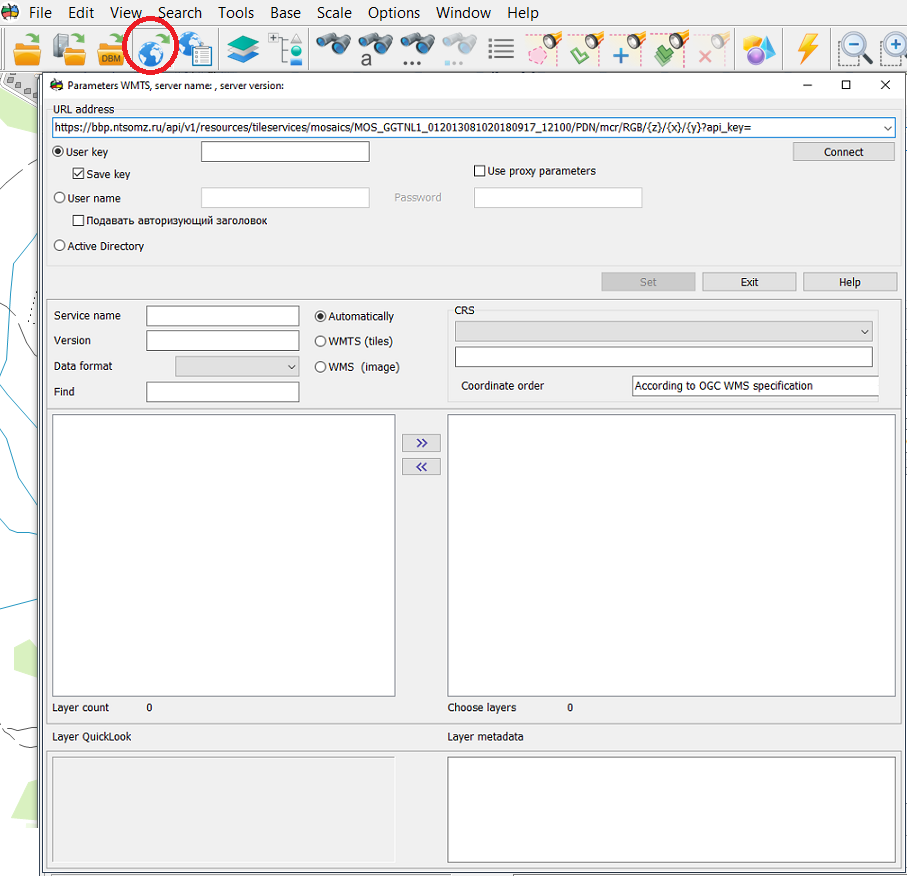
• Open GIS Panorama. • Click on the Open map from WMS-server button. • Enter the generated string into line the URL address of the server. • Click on the connect button. • Double click on the geoportal in the list of layers. • Click the Set button.
To add the indicated layer into the drop-down list of geoportals, do the following: • Open the settings file c:\Program Files\Panorama\Panorama14\wmslist_en.xml • Into the Portal node, add the section:
<Topic Link="wmslist\temp.bmp" Name="Банк базовых продуктов РКС"> <Layer Name="Покрытие1" UnicId="RKS_SAT"> <ConnectedSting> <URL><![CDATA[https://bbp.ntsomz.ru/api/v1/resources/tileservices/mosaics/MOS_GGTNL1_012013081020180917_12100/PDN/mcr/RGB/]]></URL> <AdditionalRequest><![CDATA[?api_key=api_key_from_personal_account]]></AdditionalRequest> <ID Number="1" Value="RKS_SAT"/> <Name Number="1" Value="RKS_SAT"/> <Matrix Name="GoogleMapsCompatible"/> </ConnectedSting> <PortalStadndart>UTMS</PortalStadndart> <Alghoritm>1</Alghoritm> <Transparent>0xFFFFFFFF</Transparent> <ShowColor>0</ShowColor> <ShiftX>0</ShiftX> <ShiftY>0</ShiftY> <Point X="55.94448244" Y="38.21196422"/> </Layer> </Topic>
• Save changes. • Start the Panorama. • Click button the Select geoportal from the list. • Answer «Yes» to the question about replacing the file. • The added node will appear in the drop-down list of geoportals.
|